Kayaking Mackinac Island for beginners works best as a short, guided shoreline paddle. Do not make a full-island circuit your first trip. Lake Huron can look calm from Main Street while wind, ferry wakes, cold water, and rocky landings create harder conditions offshore.
Reserve equipment or a tour after checking the day’s wind. Then paddle close to shore on the island’s protected side. Windermere Point and the water west of downtown offer convenient access. British Landing can also work when transportation and weather align.
The Mission Point side offers attractive views, but east winds can expose the shoreline to waves. First-time paddlers should avoid ferry routes and cliff-backed sections with few landing options.
Plan to get wet from at least the knees down. Mackinac Island has a rocky limestone shore instead of broad swimming beaches. Water shoes and a stable launch matter almost as much as the kayak.
What kayaking Mackinac Island for beginners is really like
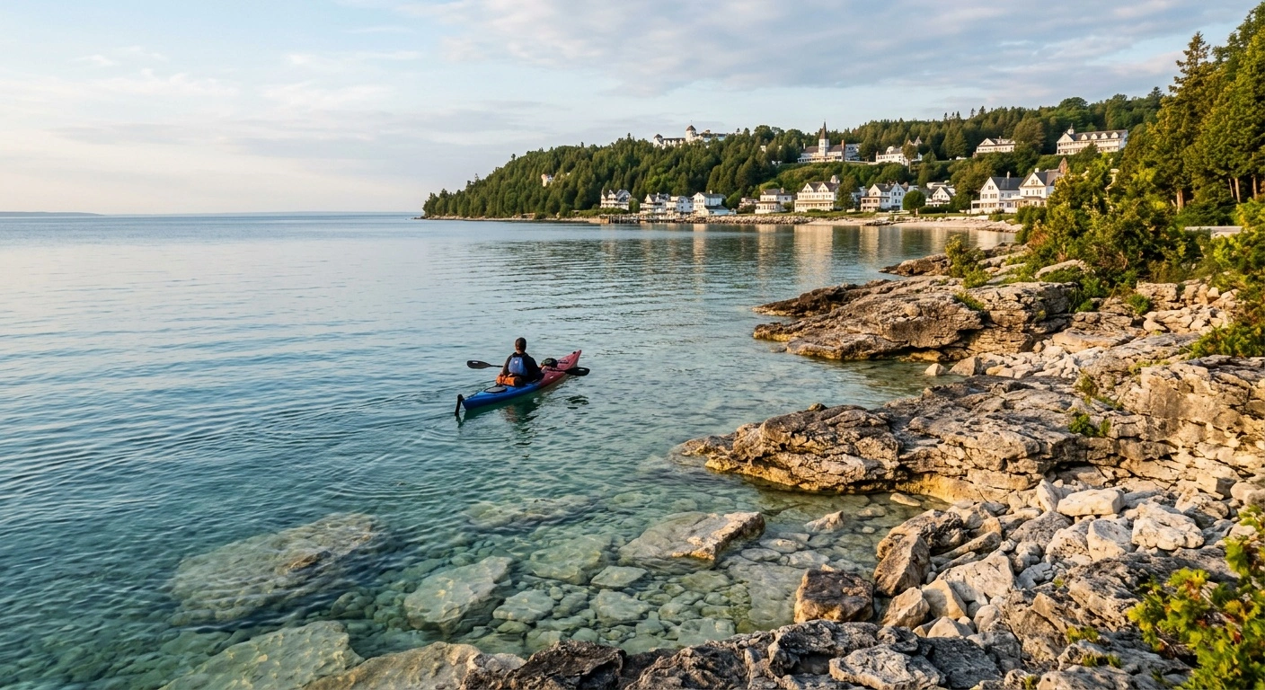
Paddling here centers on the shoreline. Expect clear water over pale stone, wooded bluffs, and views toward the village. On a calm morning, beginners can find an easy rhythm within minutes.
Near M-185, paddlers can often see cottages, bicycles, and horse-drawn traffic from the water. However, the lake does not stay placid every day. A breeze that feels pleasant on land can produce uncomfortable chop offshore.
Soft sand is rare, so most landings require stepping onto wet stones. Paddlers need enough balance to exit without slipping or scraping the kayak. Water temperatures stay cold well into the visitor season, even when the air feels warm.
Wear cold-water protection when conditions call for it. Keep a properly fitted personal flotation device, or PFD, fastened throughout the trip. Do not store it behind the seat.
- Practical starting area: Look near downtown, Windermere Point, or another protected section chosen for the day’s wind.
- Most forgiving time: Early morning often brings lighter wind and less ferry traffic.
- Local tip: Ask which shoreline has shelter that day instead of committing to one landmark.
Beginner-friendly paddling areas
No side of Mackinac Island stays calm in every wind. The right location changes with wind direction, boat traffic, and launching conditions. Beginners should choose a short shoreline section with a clear turnaround point.
Downtown offers convenient access but frequent boat traffic. Sections farther along M-185 usually see fewer ferries, although they also have fewer services. Transporting a rental kayak to an outlying launch requires advance arrangements.
Confirm that the launch allows public access and that the outfitter permits your planned route. When conditions look uncertain, paddle with a guide rather than improvising from unfamiliar shore.
Windermere Point and the west side of downtown
Windermere Point sits at the western edge of the downtown waterfront. The walk from the central ferry docks takes about five to ten minutes. Its location makes it a practical place for a first paddle with a local outfitter.
The shore has room to prepare outside the busiest part of Main Street. Still, the entry consists of rock and can become slippery. Use water shoes with firm traction.
A short out-and-back trip west lets beginners practice steering without attempting a crossing. The shoreline toward Devil’s Kitchen provides limestone scenery and views across the Straits. Turn around before anyone feels tired.
Ferry wakes reach this area, and boat traffic increases later in the day. Stay outside active ferry routes. Never cross in front of an approaching vessel.
A strong west or southwest wind can push waves directly toward this shore. Under those conditions, a guide may move the trip, shorten it, or cancel it.
The shoreline toward Mission Point
The village shoreline east of downtown leads toward Mission Point. By land, the walk from the central docks takes about 15 to 20 minutes. From the water, paddlers can see the harbor, Ste. Anne’s Church, and waterfront buildings.
This direction can suit beginners when the wind stays light. Boat traffic near downtown creates the main challenge. Passenger ferries accelerate and maneuver offshore, producing wakes even on an otherwise calm lake.
A guided departure helps new paddlers learn where to wait and which areas to avoid. Keep close to the shoreline without entering dock approaches or marked traffic lanes.
Beyond Mission Point, the coast becomes more exposed and offers fewer obvious landing places. Arch Rock rises above this side of the island, but beginners should not treat it as a required destination. Use Mission Point as a general turnaround area when conditions allow.
Avoid this shoreline during an onshore east wind. Waves can build quickly and make rocky landings difficult.
British Landing on a calm day
British Landing lies on the island’s northwestern side, about four miles from downtown along M-185. It has open shoreline views and less ferry congestion than the village waterfront. The setting feels quiet even while cyclists pass on the perimeter road.
Equipment transport creates the main obstacle. Cycling from downtown often takes 25 to 40 minutes, but carrying a kayak by bicycle is not practical. Arrange a guided outing or confirm delivery and retrieval with the outfitter.
British Landing faces wind from several directions. Calm water can also deteriorate while paddlers take a long break onshore. For a first outing, stay close to the launch and within easy reach of land.
Mackinac Island State Park does not charge admission simply to visit this area. Kayak rentals and guided outings cost extra.
The southwest shore near Devil’s Kitchen
Devil’s Kitchen is a limestone formation along M-185 southwest of downtown. The walk from the village takes roughly 30 to 40 minutes. A bicycle shortens the trip.
The nearby water offers broad views toward the Mackinac Bridge. It can support a compact paddle when both wind and boat wakes remain light. However, the shore has more exposure than it appears to have from the road.
Some sections have awkward stones that complicate launching. Waves may also push a kayak sideways during entry. Paddlers must watch traffic in the Straits, not only passenger ferries.
Staying near shore limits exposure but does not eliminate wakes. Ask for local advice and set a conservative turnaround point. This area poorly suits small children or anyone uncomfortable with a wet exit.
Fatigue also matters. A group tired from bicycling may struggle with the launch and return paddle. If the wind starts building, visit Devil’s Kitchen by land and kayak another day.
Renting gear and choosing a guide
Great Turtle Kayak Tours is the established island outfitter to contact about guided paddling and rentals. It operates seasonally, generally from late spring through early fall. Summer usually brings the widest availability.
Opening dates, staffing, and schedules can change each year. Confirm operations before visiting in May, late September, or October.
A guide offers clear value for anyone who has never launched from rock. Guides also help paddlers understand ferry traffic and choose a route for the current wind. Book one if you want to paddle toward a specific landmark.
Guided trips cost more than basic rentals. Depending on the length and format, prices may reach the low hundreds per person. Short rentals often cost several dozen dollars, but seasonal rates change.
Reserve ahead for summer weekends, holidays, and outings tied to a ferry schedule. Ask about clothing, route selection, included equipment, and weather cancellations. Also confirm the meeting point before leaving the mainland.
A responsible operator should supply a kayak, paddle, and properly sized PFD. The staff should also explain the launch and basic controls before departure. Beginners should request a stable recreational kayak rather than a narrow boat built for speed.
Choose a route that allows for mistakes
A useful beginner route keeps the return leg manageable. Wind can make an easy outbound paddle much harder on the way back. New paddlers may not notice a gradual drift until they turn around.
Choose an out-and-back route near a known launch. This plan usually creates less risk than paddling between distant points. It also allows the group to shorten the trip quickly.
Set both a turnaround time and a turnaround location before leaving. A time limit stops the group from continuing just because a landmark looks close. Save time for landing, changing clothes, and returning equipment.
Do not schedule the outing to end immediately before your final ferry. A slow landing or equipment delay could leave you rushing across town.
A first-time route
For a first outing, spend 45 to 75 minutes on the water near the outfitter’s chosen launch. Use the first few minutes to practice forward strokes, stopping, turning, and approaching shore.
Next, follow the shoreline in the more protected direction. Do not cross open ferry routes. Turn around while every paddler still feels comfortable.
Beginners often underestimate fatigue in their hands, shoulders, and lower backs. Keep enough energy for a controlled landing on uneven stones.
Children should ride with an experienced adult in an appropriate tandem kayak. Follow the outfitter’s age and safety rules. Shorten the trip if a child feels nervous or wakes become frequent.
A longer beginner route
Paddlers with basic stroke and wet-exit experience can consider a longer shoreline tour. Choose the direction according to that day’s conditions. Options may include heading west toward Devil’s Kitchen or east toward Mission Point.
Both directions provide scenery without requiring an open-water crossing. Neither stays protected in every wind. Turn back if waves build or the group loses speed.
Use a guide if the group lacks Lake Huron experience or plans to continue beneath the bluffs. Parts of the eastern shore offer few stopping places. Distances also look shorter from the water than they feel while paddling.
Carry drinking water and a small snack for any trip lasting more than a brief session. Secure both where they will remain accessible.
Do not circle the island on a beginner trip. The water route roughly follows the island’s 8.2-mile perimeter, but paddling introduces wind, wakes, and difficult landings. Experienced paddlers should seek current local advice before attempting the full loop.
Cold water, wind, and ferry traffic
Lake Huron stays cold enough to make an unexpected capsize dangerous, even on sunny days. Dress for the water temperature rather than the afternoon air. Ask whether you need a wetsuit, paddling jacket, or another cold-water layer.
Avoid cotton because it holds water and draws heat from the body. Choose quick-drying synthetic or wool layers instead.
Fasten your PFD correctly and wear it throughout the outing. Keep your phone in a waterproof case, but do not depend on cell service for safety. Paddle with a partner or guide.
Attach a retainer to sunglasses. Store keys, wallets, and other valuables in a properly closed dry bag.
- Check the wind direction and current forecast immediately before launching.
- Stay clear of ferry docks, ferry routes, and maneuvering vessels.
- Avoid paddling in fog, thunderstorms, strong wind, or fading light.
- Keep the group together and set a turnaround time before departure.
- Wear water shoes with traction for wet limestone and loose rock.
- Tell someone on land where you plan to go and when you expect to return.
Offshore wind requires particular caution because it can carry a tired paddler away from land. If you capsize and cannot re-enter, stay with the kayak whenever possible. The boat provides flotation and makes you easier to spot.
Beginners who have not practiced re-entry should remain very close to shore. A guide provides additional support but cannot remove every risk.
When to kayak Mackinac Island
Summer brings the warmest air and the most reliable outfitter schedules. It also brings more ferries and recreational boats, especially around midday. Early morning often provides lighter wind and less traffic.
Late spring offers quieter shorelines but colder water and rapidly changing weather. Do not assume that rentals or tours operate every day in May.
Early fall may also feel quiet. However, shorter days, cool air, and reduced schedules require more planning. Check both ferry and outfitter hours before traveling.
Many visitor-focused businesses close between late October and early May. Winter ferry access varies with the season and ice conditions. Ordinary recreational kayaking does not fit a typical winter visit.
Even in summer, an outfitter may postpone or cancel a trip because of wind. Keep the rest of the day flexible instead of forcing a paddle into unsafe conditions.
Getting to the launch without a car
Passenger ferries serve Mackinac Island from Mackinaw City and St. Ignace. Visitors can also take a small plane to the island airport. Most ferry passengers park on the mainland and check larger luggage for porter service.
Ferries arrive downtown. From there, visitors travel on foot, by bicycle, or in a horse-drawn taxi. The island prohibits most motor vehicles, with exceptions for emergency and limited service use.
Do not expect rideshare service or a rental car at the dock. Most downtown kayak departures sit within a short walk. Mission Point takes about 15 to 20 minutes to reach on foot.
British Landing requires a roughly four-mile trip along M-185. Do not try to balance a standard kayak on a rental bicycle. Confirm equipment delivery, launch location, and return arrangements in advance.
Ask whether the outfitter can store personal belongings during the trip. Day visitors should also check the final ferry departure for their route. Ferry schedules change with the season.
Leave time to return equipment and walk to the correct dock. Several ferry docks sit along the downtown waterfront, so verify the departure location.
Build the day around lake conditions
Reserve an early outing, then keep the afternoon open for land-based activities. If the lake stays calm, paddle a protected shoreline section and finish before the wind strengthens.
If conditions deteriorate, bicycle M-185, walk to Arch Rock, or visit Fort Mackinac instead. Do not pressure a guide to launch or preserve a reservation when the lake looks unsafe.
Pack water shoes, quick-drying layers, sun protection, and dry clothes. Before boarding the ferry, confirm the operating schedule, current price, meeting point, and cancellation policy.
The safest approach to kayaking Mackinac Island for beginners puts current conditions ahead of a fixed route. A calm hour near shore makes a better first trip than a long itinerary forced into the wrong day.